Anyone shopping for a home in Marin right now is getting a crash course in flood zones, fire zones, and the insurance costs that come with them. When I moved here more than 30 years ago, none of that was part of the conversation. Earthquakes were the topic — the "big one" was always supposedly imminent. We're still waiting, and I hope we keep waiting, but Mother Nature runs on her own schedule, not ours.
Here's what I think every Marin buyer should understand going in:
1. There isn't one flood zone or fire zone — there are several, from different agencies, and they don't always agree. FEMA sets flood zones at the federal level; CAL FIRE designates Fire Hazard Severity Zones at the state level; counties and fire districts can layer on their own local requirements. A property can look very different depending on which map you're reading.
2. Insurers don't all score risk the same way. Each company runs its own proprietary wildfire and flood risk model, so it's common for one carrier to flag a home as high risk while another writes a policy without blinking. There's no single "official" risk score that all insurers use.
3. Insurers manage risk by the block, not just the house. It's common to see one company insure several homes on a street and decline others with a nearly identical risk profile, simply because they're capping their total exposure in that zip code or neighborhood.
4. Get multiple quotes — always. I've seen identical homes with identical coverage come back with quotes that differ by thousands of dollars a year. Shopping around isn't optional in this market. Make sure your agent has many insurance brokers and strategies. Some insurance companies and insurance agents are better for fire, flood, older homes and/or low risk homes.
5. Not all flood zones are equal. Some properties are technically "in a flood zone" simply because they're near water and have never flooded. Others flood regularly. Pulling actual insurance claims history for an area — not just the zone designation — gives you a much clearer picture of real risk versus paper risk.
6. Fire risk is about more than proximity to trees. Insurers and fire officials also weigh things like defensible space, roof and building materials, and — critically — access: how easily can a fire engine reach the home, and how many roads in and out does the neighborhood have? Single-road-access communities on narrow, winding roads tend to carry meaningfully higher risk profiles, regardless of vegetation.
7. If standard carriers say no, you still have options. When traditional insurers decline coverage, the California FAIR Plan is the state's insurer of last resort for fire risk — though it typically requires pairing with a separate "DIC" (difference in conditions) policy to cover what the FAIR Plan excludes, like theft, liability, and water damage. It's more expensive and more paperwork, but it’s an option when standard coverage isn't available.
8. Earthquake insurance is the risk almost nobody carries. Statewide data consistently shows only about 10–14% of California homeowners carry earthquake coverage — high premiums and steep deductibles (typically 10–25% of the coverage amount) are the main reasons people skip it. For older or un-retrofitted homes, it's worth pricing out: a seismic retrofit can qualify a homeowner for a meaningful discount, up to 25%, on CEA earthquake premiums.
9. Sea level rise (separate from current flood zones). This is a slower-moving but very real one for Marin. The county's shoreline studies show more than 110 miles of bay and coastal shoreline exposed, with Marin City, the Canal neighborhood, Santa Venetia, Larkspur shoreline neighborhoods, and Sausalito's floating home community flagged as particularly vulnerable — and the county estimates roughly $17 billion in long-term adaptation needs countywide. A home can be outside today's FEMA flood zone and still face rising long-term exposure; worth asking whether a property has been assessed under the county's BayWAVE / sea level rise vulnerability studies.
10. Landslide risk is real in Marin's hillside communities. New city-commissioned mapping (Dec. 2025) found roughly 80% of Sausalito's 3,397 parcels sit on steep slopes, nearly 60% at 25+ degrees — prompting the city to consider a hillside ordinance. It's not hypothetical: a February 2019 hillside failure on Sausalito Boulevard sent a duplex sliding into a neighboring home, destroyed two structures, and evacuated roughly 50 homes; a similar slide killed a resident in the January 1982 storm. West Marin has its own trouble spots too — Bolinas Road near Fairfax has needed repeated multimillion-dollar repairs after 2023 and 2024 storm slides, being the sole access road for hundreds of homes. Steep hillside neighborhoods deserve the same scrutiny as fire and flood zones, especially in older homes built before modern geotechnical standards were in place.
At the end of the day, everyone's risk tolerance is different, and no one can predict exactly what will happen. But the data points in one direction: both USGS and IPCC research indicate flood and wildfire risk in California are likely to intensify, not ease up.
And yet buyers keep buying in high fire and flood zones — until one event changes the calculus. After the 2017 North Bay firestorm (the Tubbs, Nuns, and Atlas fires alone destroyed over 8,000 structures across Sonoma and Napa counties), I saw a real shift: buyers started asking much more pointed questions about how far up a winding hillside a home sat and whether it fell in a High or Very High Fire Hazard Severity Zone. More recently, the compound flooding and record king tides that hit Marin this past January — flooding neighborhoods in Larkspur and Corte Madera and prompting a county emergency proclamation — did the same thing for flood-zone awareness.
It's reasonable to expect property values in the most exposed areas to feel the pressure over time if current climate trends continue.
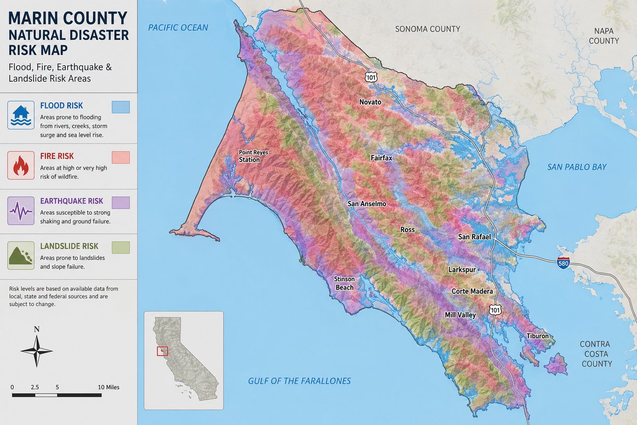
Image caption:
This map was AI-generated for illustrative purposes and isn't intended to be 100% accurate. The point it's meant to make: finding a property in Marin with zero natural hazard exposure is nearly impossible. Understanding where and how these risks show up — and what they mean for insurability and cost — is a key part of buying here, and it's exactly where your agent should be guiding you.